Two tropical storms being monitored by National Hurricane Center, one is heading to the Caribbean
At the climatological peak of tropical cyclone activity, the Atlantic is relatively inactive with only two tropical waves and one of them could become a tropical depression or tropical storm as it heads toward the Caribbean and could subsequently impact southwestern Mexico.
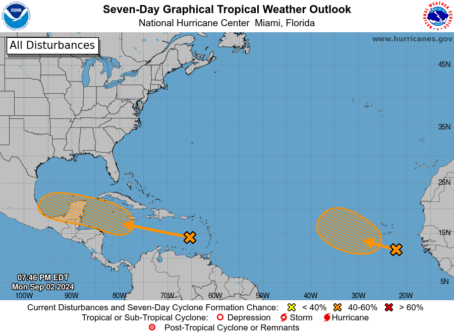
The National Hurricane Center (NHC) is monitoring two tropical systems over open waters. One is heading toward the Caribbean and the other system has jumped from West Africa into the Atlantic over open waters.
Prediction of these tropical waves by the NHC
These are the NHC's predictions for these tropical waves during the next few days shown below:
Tropical wave towards the Caribbean
A westward-moving tropical wave is producing disorganised showers and thunderstorms, accompanied by locally heavy rain and strong wind gusts, over portions of the eastern Caribbean Sea and adjacent land areas.
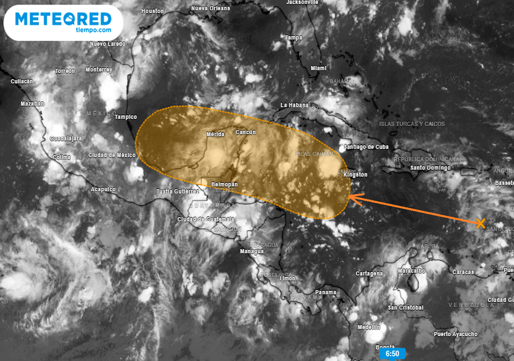
Environmental conditions are forecast to become more conducive for development as the system reaches the western Caribbean Sea and southwestern Gulf of Mexico late this week and through the weekend, and a tropical depression could form during that time.
- Formation chance through 48 hours...low...near 0 percent.
- Formation chance through 7 days...medium...40 percent.
Wave in the Eastern Tropical Atlantic
A tropical wave over the eastern Atlantic is producing showers and disorganised thunderstorms. Environmental conditions are forecast to become somewhat more conducive for development, and a tropical depression could form within days as the disturbance moves slowly west-northwestward or northwestward over the eastern tropical Atlantic Ocean.
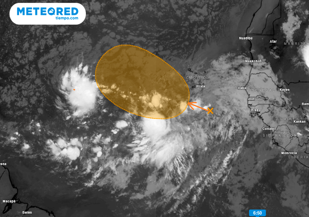
This system could produce locally heavy rainfall and gusty winds across portions of the Cabo Verde Islands in the next day or two.
- Formation probability up to 48 hours...low...10 percent.
- *Formation probability up to 7 days...medium...40 percent.
If these tropical lows do eventually develop into tropical storms, they would be given the names Francine for the first system, and Gordon would be the next one.
Latest NEC forecast
NEC said in their latest forecast update (as of 3 September) for the Caribbean Sea that; "Disorganised showers and thunderstorms continue in association with a westward-moving tropical wave located over the eastern Caribbean Sea," where a tropical system could eventually develop.
Meanwhile, it states on the same forecast that for the Eastern Tropical Atlantic Ocean: "A tropical wave over the far eastern Atlantic is producing disorganised showers and thunderstorms." Here, a tropical depression could form in several days, as it moves slowly north-west over the eastern tropical Atlantic Ocean, later leading to heavy rain and gusty winds.


