There is a ghost island that appears and disappears in the Caspian Sea, a geophysicist clarifies the mystery
Similar phenomena have been occurring in this region of the planet for more than a century, but it is only now, thanks to technology, that they have been able to be observed in real time and with an astonishing level of detail.
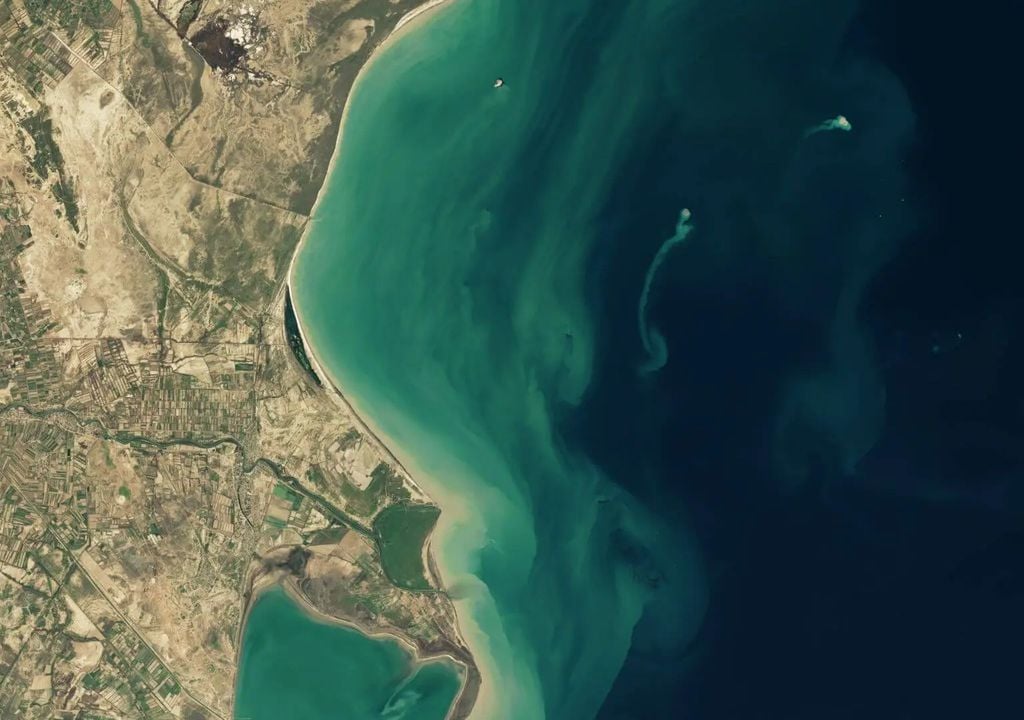
The calm waters of the Caspian Sea, the largest inland body of water on the planet, located between the continents of Europe and Asia , have been the scene of a fascinating geological phenomenon that has attracted the attention of scientists and observers around the world: the appearance and disappearance of a phantom island.
The event has been documented by NASA satellites, and proves how the geological uniqueness of the Azerbaijan region and the interaction of tectonic and volcanic forces can give rise to ephemeral geological formations such as this one.
Mud Volcano Region
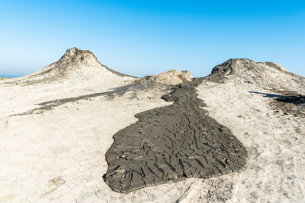
The convergence of the Arabian and Eurasian tectonic plates in the area makes the Azerbaijan region known for its high concentration of mud volcanoes : more than 300 have been recorded both on land and in the Caspian Sea.
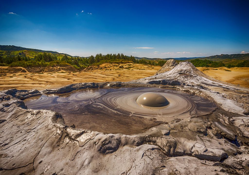
Unlike traditional volcanoes, which expel lava, these other types of volcanoes are geological structures that, due to underground pressure and tectonic activity, eject a colder and more viscous material. Specifically, a mixture of mud, sediments and gases that are capable of altering the underwater landscape.
The history of this island "begins" in November 2022, with the eruption of one of these mud volcanoes, the one known as Kumani Bank , located approximately 25 kilometers from the Azerbaijani coast.
This is how the "new" island emerged
The ejection of a considerable amount of mud and sediment from the Kumani Bank onto the sea surface resulted in the formation of a new island about 400 metres wide. This was actually recorded on more than six occasions from 1900 to 2000.
#VicioNoticias Una isla desaparece en solo 3 años y la NASA encuentra la explicación
— Revista Vicio (@revista_vicio) January 22, 2025
El OLI (Operational Land Imager) y el OLI-2 de los satélites Landsat 8 y 9 capturaron estas imágenes que muestran cómo la isla emerge y se encoge. pic.twitter.com/VuyLcMapTS
The phenomenon occurred between January 30 and February 4, 2023, as shown in recently released images captured by NASA's Landsat 8 and 9 satellites . Geophysicist Mark Tingay rediscovered it by analyzing satellite images.
On February 14 of that same year, the island was already clearly visible and was accompanied by a plume of sediment that extended into the surrounding water.
A transitory nature
But, like other formations of this nature, composed of a material much less resistant than volcanic rock , the island was not destined to last over time, explains Tingay.
So the special environmental conditions of the Caspian Sea , including wave action and currents, began to erode it soon after its appearance.
By the end of 2024, satellite images showed a significant reduction in its size, until it almost completely disappeared beneath the surface of the water.
Other ephemeral islands
The appearance and disappearance of islands in the Caspian Sea is not a new phenomenon. Since its first recorded eruption in 1861, the Kumani Bank volcano has been responsible for the formation of transient islands on multiple occasions.
In 1950, one of these eruptions resulted in the formation of another island, which on that occasion reached a width of 700 metres and a height of 6 metres.
However, like the one sighted in 2023, this island also quickly succumbed to natural erosion , and ended up disappearing, also, in less than a year.
Real-time tracking
Unlike other islands that have emerged from the volcanic activity of the Kumani Bank, this time it has been possible to monitor this phenomenon in real time thanks to advances in technology.
The #Landsat 9 observatory has successfully separated and is on its way to continue 50 years of uninterrupted Earth observations pic.twitter.com/TqjP4ZGOLu
— NASA (@NASA) September 27, 2021
NASA's Landsat 8 and 9 satellites, equipped with the Operational Land Imager (OLI) and OLI-2 instruments, have allowed scientists to observe and document the evolution of this ephemeral formation in unprecedented detail.
Continuous monitoring provides valuable information on the geological dynamics of the Azerbaijani region and how environmental factors influence the stability of new land formations.


