Hurricane Francine: Life-threatening storm surge, rainfall, and tornadic development expected in the USA
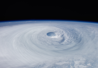
It is the peak of hurricane season in North America and the Gulf activity is heating up. Hurricane Francine is expected to bring dangerous conditions to the Gulf Coast on Wednesday as landfall approaches.

The tropical disturbance that had formed several days ago in the Gulf of Mexico has officially been deemed a Category 1 Hurricane as of Tuesday afternoon. Hurricane Francine is expected to strengthen quickly as it moves into a warm favourable environment throughout Wednesday before making landfall.
Francine is expected to bring significant impacts to the US coast and the Mississippi Valley in the upcoming days due to heavy amount of rainfall, storm surge, and severe storms throughout the rest of the week as it tracks to the north.
Forecast and timing of Francine
The National Hurricane Center is now forecasting landfall on Wednesday in the late afternoon or evening along the southern Louisiana coast. Forecast models are indicating rainfall rates of 4 inches per hour, more accumulation is possible in southern Louisiana.
As a result, the flooding threat is heightened for cities like New Orleans, Baton Rouge, and the surrounding locations. The storm surge will likely to cause additional coastal flooding, however, the intense winds are expected to bring additional concerns and damage.

After Francine makes landfall, the system will rapidly lose strength as it tracks to the north. By Friday morning, Francine is expected to downgrade to a tropical depression, yet still bring impacts to the Midwest.
Impacts: Storm surge, heavy rain, and severe potential
Dangerous storm surge along the coast of Texas, Louisiana, Mississippi, Alabama, and the panhandle of Florida is expected on Wednesday. At peak surge, waters could reach up to 10 feet above land in some locations.
9/10 4 pm CDT: There is a danger of life-threatening storm surge from #Francine for the Louisiana and Mississippi coastlines, where a Storm Surge Warning is in effect. Residents in the warning area should follow advice, including evacuation orders, given by local officials. pic.twitter.com/0eGsyYnSaR
— NHC Storm Surge (@NHC_Surge) September 10, 2024
The Weather Prediction Center has highlighted a moderate risk along the Gulf Coast stretching from southern Louisiana to central Mississippi on Wednesday. This indicates the threat of numerous instances of urban as well as flash flooding. In fact, rainfall totals over 5 inches and rainfall rates of 2 to 3 inches per hour will be likely over the course of the day on Wednesday.
Though the highest risk of disastrous flooding lies in the highlighted moderate risk, the threat of flooding will also encompass much of east Texas, stretching north to Tennessee as well as across the state of Florida. The longer range forecast indicates high probability of heavy rainfall through this week as the system tracks to the north.
A MODERATE risk is in effect in our Day 2 Excessive Rainfall Outlook. More details: https://t.co/FQU5sbmsxo pic.twitter.com/QgjcpF1ful
— NWS Weather Prediction Center (@NWSWPC) September 10, 2024
In addition to the high flood threat, the Storm Prediction Center has highlighted areas of concern for isolated and scattered severe storms through Thursday. Tornadic development is the biggest risk in the locations highlighted from Louisiana to the panhandle of Florida. The key danger with Hurricane Francine will include the dangerous storm surge, flooding, and life-threatening winds. The impacts are likely through Friday morning, stay tuned for the latest updates!


